
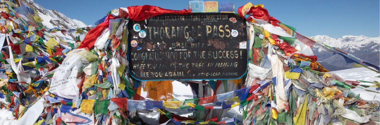
Thorong La Pass
Thorong La Pass is the highest trekking pass in Nepal, after the Chola Pass, Khongmala Pass, Renjola Pass, and Selele Pass. It is in the Annapurna region at an elevation of 5416 m (17769 ft) above sea level. and located between the Manang Valley and Mustang, thus linking the eastern and western stretches of the Annapurna Himalaya range. The pass is cherished for its high altitude, difficulty to cross, and vast Himalayan views.
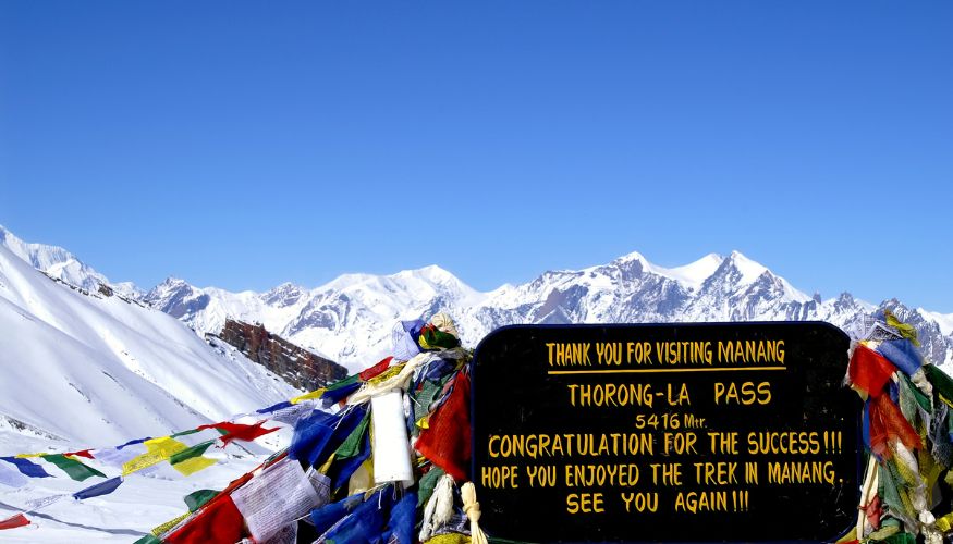
Crossing the Thorong La Pass is a major feature of the trek between Manang and Muktinath as you head over Thorong La Pass. The path slowly but steadily climbs up the Manang Valley, over the pass and down to Muktinath on the other side. At 5,416 m (17,769 feet), Thorong La is an entirely different crossing that necessitates ensuring proper acclimatization and physical preparation, where good gear and pace are equally important.
What Is Thorong La Pass?
Thorong La Pass is a high mountain pass along the Annapurna Circuit Trek. Trekkers cross Thorong La to travel from Manang toward Muktinath, making it one of the main highlights of the circuit route.
This high mountain pass is located above rugged Himalayan landscapes, majestic snowy summits, and expansive landscapes of both Annapurna and Mustang. Due to the elevation and challenging walk to reach Thorong La Pass, an acclimatization strategy is important in order to ascend it whilst maintaining a slow pace of travel.
Where Is Thorong La Pass Located?
Thorong La Pass is located between Manang District and Mustang District, in the Annapurna region of north-central Nepal.
It is one of the primary crossing points along the ACT. The typical trekker’s route to the pass is from the Manang side, via Yak Kharka and Thorong Phedi or High Camp, crossing Thorong La and descending towards Muktinath in Mustang. The region is located in the high-altitude, rugged mountain terrain of the Annapurna Circuit Himalayas.
Thorong La Pass Location and Key Details
| Detail | Information |
| Location | Annapurna region, north-central Nepal |
| Altitude | 5,416 m (17,769 ft) |
| Eastern Side | Manang District |
| Western Side | Mustang District |
| Main Trekking Route | Annapurna Circuit Trek |
| Approach Route | Manang – Yak Kharka – Thorong Phedi/High Camp |
| After Crossing | Thorong La – Muktinath (Hindu Temple) |
| Highest Point | Thorong La Pass is the highest point of the classic Annapurna Circuit |
| Terrain | High-altitude mountain terrain, rocky trails, and exposed slopes |
| Main Challenge | High altitude, steep ascent, cold weather, and changing mountain conditions |
Thorong La Pass Altitude
At an altitude of over 5,416 meters (17,769 feet) above sea level, Thorong La Pass is the highest point on the classic Annapurna Circuit Trek. Because of the high elevation, there is less oxygen in the air.
Therefore, walking becomes more strenuous, and trekkers may experience fatigue, shortness of breath, headaches, or other symptoms of altitude sickness.
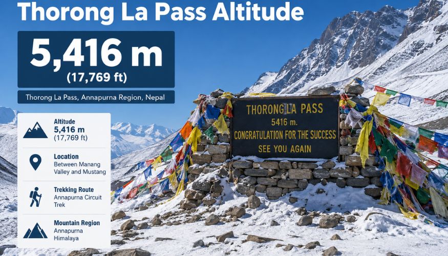
The trail makes a steep ascent as it heads up from the Manang Valley, passing Yak Kharka and Thorong Phedi (High Camp) before reaching the pass. As such, sufficient acclimatization is critical, allowing the body to adapt and adjust to increased altitude.
Trekking is a slow, steady process that gives trekkers time to acclimatise safely, take the high-altitude crossing at their own pace, rest regularly, hydrate well, and avoid rushing.
Why Is Thorong La Pass Famous?
Thorong La Pass is one of the most iconic high-altitude trekking passes in Nepal & a highlight along the Annapurna Circuit Trek. The pass is a crucial leg of the journey at an altitude of 5,416 meters above sea level (18,769 feet), making it accessible only via slow ascent from the Manang side.
The pass provides views of the surrounding Himalayan mountains, high valleys and dry mountain scenery. Tough physical effort is needed to cross, as you work your way up a high, steep ascent in cold conditions and then descend from here over a long distance toward Muktinath.
What Can You See From Thorong La Pass?
From Thorong La Pass at 5,416 meters, trekkers can see the rugged Himalayan landscape on both sides of the pass. Views include parts of the Annapurna and Dhaulagiri ranges, surrounding high mountain peaks, and the dry landscape of Mustang.
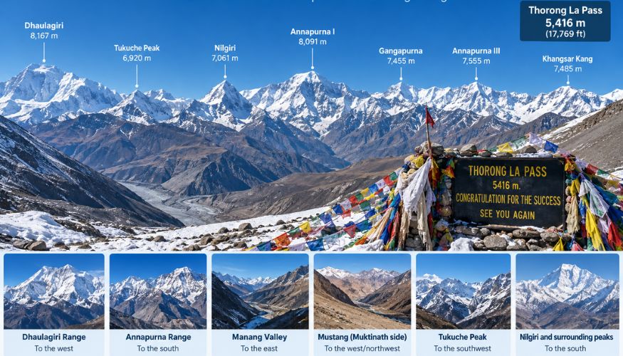
Looking toward the Mustang side, the terrain drops toward the Kali Gandaki Valley, creating a clear contrast between the high pass and the lower valley. Visibility depends on weather and cloud conditions, so the extent of the mountain views can vary on the day of the crossing.
How Difficult Is Thorong La Pass?
Crossing the Thorong La Pass at 5,416 meters (17,769 feet) is one of the most strenuous parts of the Annapurna Circuit Trek.
High altitude, long walking days, steep ascents, and exposure to cold temperatures with constant westerly winds along the Himalayas make it even colder during the winter seasons of the year. Because of the thin air at this elevation, altitude sickness can rear its ugly head, so it is important that trekkers undergo acclimatization a slow but steady pace along with hydration and preparation.
The descent down toward Muktinath after crossing the pass is long and can be rough on the legs! The Thorong La Pass can be crossed by beginner trekkers, but it is more suited for those who are physically prepared, have followed an appropriate acclimatization itinerary, and enjoy high-altitude trekking long days.
Worth Reading: Annapurna Circuit Trek Difficulty
Why Is Thorong La Pass Famous?
Thorong La Pass may be one of the most well-known, high-altitude trekking passes in Nepal and is also a significant feature of the Annapurna Circuit Trek.
The highest and most challenging point of the journey is crossing the pass at 5,416 meters (17,769 feet), a steady uphill trek from Manang. The views here are of the neighbouring Himalayan mountains, above high valleys, when entering rugged mountain passes on your way. This is an arduous crossing because of the high elevation, cold, and a 3-day ascent followed by a long descent towards Muktinath.
Best Time to Cross Thorong La Pass
Typically, spring (March-May) and autumn (September-November) are the best times to cross Thorong La Pass comfortably. The seasons are typically characterized by more stable weather, clear mountains & better trail conditions for crossing the high pass.
In winter months, you may experience heavy snow, freezing temperatures and treacherous or occasionally impassable trail conditions; the monsoon season (June-August) can bring rain clouds and varying trail conditions along lower sections of the route. Hence, spring and autumn are much better choices, with relatively high places to reach the pass by taking the scenic bus ride down toward Muktinath.
Is Thorong La Pass Safe?
Yes, Thorong La Pass is safe. with proper preparation and acclimatization. Out of the five steps, those would be: check the weather before crossing, leave earlier, go slow, bring plenty of water and avoid alcohol. Wear warm, clothes which are layered and trekking boots. A guide can provide route and safety support, which is ideal for those inexperienced in the area. Get travel insurance with an emergency evacuation policy. If you get serious altitude symptoms or the conditions are unsafe, then stop and come back down.
FAQs About Thorong La Pass
Where is Thorong La Pass located?
Thorong La Pass is located in the Annapurna region of north-central Nepal, between Manang and Mustang.
How high is Thorong La Pass?
Thorong La Pass is at 5,416 meters (17,769 feet) above sea level.
Why is Thorong La Pass famous?
It is famous as the highest and most challenging point of the classic Annapurna Circuit Trek, known for its high-altitude crossing and Himalayan landscapes.
Is Thorong La Pass difficult?
Yes. The crossing is physically demanding because of the high altitude, steep ascent, cold weather, and long descent.
How long does it take to cross Thorong La Pass?
The crossing from Thorong Phedi or High Camp to Muktinath generally takes around 7–10 hours, depending on the route, weather, walking pace, and rest breaks.
How far is Thorong La Pass from Thorong Phedi?
Thorong La Pass is approximately 4–5 km from Thorong Phedi, depending on the route and exact trail measurements.
How far is Thorong La from Muktinath?
The distance from Thorong La Pass to Muktinath is approximately 14–16 km, mostly downhill.
What is the best time to cross Thorong La Pass?
The best seasons are generally spring (March–May) and autumn (September–November) because of more favourable weather and trail conditions.
Can beginners cross Thorong La Pass?
Yes, Fit beginners can cross Thorong La with proper preparation, acclimatization, and a suitable itinerary, but the high altitude makes it more demanding than regular trekking.
Is altitude sickness common at Thorong La?
The risk of altitude sickness increases at 5,416 meters. Proper acclimatization, slow walking, hydration, and avoiding rapid ascent are important.
Do I need a guide for Thorong La Pass?
A guide is strongly recommended for route support, altitude awareness, weather conditions, and emergency assistance.
What should I wear at Thorong La Pass?
Wear warm layered clothing, a down or insulated jacket, gloves, a warm hat, trekking pants, and proper trekking boots. Sunglasses and sun protection are also important.
Can you cross Thorong La Pass in winter?
Winter crossings are possible in suitable conditions but can be difficult because of heavy snow, freezing temperatures, strong winds, and blocked trails. Conditions should be checked before attempting the crossing.
Is Thorong La Pass open during monsoon?
Thorong La can sometimes be crossed during the monsoon, but rain, clouds, snow, and changing trail conditions can affect the route. Weather and trail conditions should be checked before crossing.
Conclusion
Thorong La Pass in the Annapurna region is a major high pass of Nepal that has an elevation of 5,416 meters (17,769 ft) and is the highest point on the Annapurna Circuit Trek. Due to the high altitude, steep climbing to the summit, and different cold conditions with a long descent, this pass is physically demanding; hence, proper acclimatization and preparation are important. Spring (March–May) and autumn (September–November) are usually the most favourable for crossing. With suitable equipment, fitness preparation, a gentle pace and proper planning, the crossing is far more comfortable and safe for trekkers. To cross Thorong La, check out our Annapurna Circuit Trek for the full route and itinerary.