
How Many Regions Are There in Nepal?
When people talk about regions in Nepal, they are often talking about different things without realizing it. Some mean provinces, some remember development regions, and others think about mountains, hills, and plains. And that confusion is natural, because Nepal has officially used three different “regional systems” over the last 50+ years.
Nepal is officially divided into 7 provinces, a system introduced by the Constitution of Nepal 2015. But before that, the country was organized into 5 development regions for 43 years (1972–2015). And alongside both systems, Nepal has always been explained using 3 geographic regions based on altitude and landform.
So the real answer depends on what kind of region you mean. Once you separate administrative regions from geographic regions, the picture becomes clear and much easier to understand.
Quick Summary
- Nepal has 7 provinces today
- Provinces became official in 2015
- Nepal had 5 development regions before 2015
- Nepal has 3 geographic regions by altitude
- Different systems serve different purposes
Note: Administrative and geographic regions are not the same thing.
How Many Regions Are There in Nepal Today?
Officially, Nepal has 7 regions today, and these are called provinces (Pradesh). This system was created by the Constitution of Nepal, adopted on 20 September 2015, and fully implemented between 2017 and 2018. Each province has its own provincial government, assembly, and chief minister.
These 7 provinces replaced all older administrative systems, including zones and development regions. They are the only constitutionally valid administrative regions in Nepal today, defined under Schedule 4 of the constitution and empowered by Schedule 6.
So if the question is about governance, administration, or law, the answer is simple: Nepal has 7 provinces.
The 7 Provinces of Nepal
| Province Name | Capital | Official Name Year |
| Koshi Province | Biratnagar | 2023 |
| Madhesh Province | Janakpur | 2022 |
| Bagmati Province | Hetauda | 2017 |
| Gandaki Province | Pokhara | 2018 |
| Lumbini Province | Deukhuri | 2020 |
| Karnali Province | Birendranagar | 2018 |
| Sudurpashchim Province | Godawari | 2018 |
Nepal’s 7 provinces were initially numbered Province 1–7 in 2015. Between 2017 and 2023, each province adopted a permanent name through its provincial assembly. These provinces now handle responsibilities like secondary education, provincial health services, agriculture, infrastructure, and local coordination.
For travelers, this is why maps and permits now reference provinces like Gandaki Province (home to the Annapurna Region) or Bagmati Province, which includes Kathmandu. For climbers and trekkers heading to the Everest Region, provincial administration matters more than older regional terms.
How Many Development Regions Were There in Nepal?
Before 2015, Nepal was divided into 5 development regions. This system was introduced in 1972 during the monarchy and remained in use for 43 years, until the new constitution replaced it. These regions were designed to support balanced national development, not local self-governance.
Even today, many older textbooks, reports, and websites still mention these development regions, which is why confusion persists online. But administratively, they were formally abolished in 2015.
Point to Remember: Development regions are historical, not current.
Nepal’s 5 Development Regions
| Development Region | Direction | Headquarters |
| Eastern | East | Dhankuta |
| Central | Central | Kathmandu |
| Western | West | Pokhara |
| Mid-Western | Mid-West | Birendranagar |
| Far-Western | Far-West | Dipayal |
These 5 development regions grouped Nepal broadly by east–west direction. They coordinated planning, education, and health programs but had no real political power. Decisions still came from Kathmandu, which limited local impact.
This system worked for centralized planning but struggled to address regional inequality. That limitation became one of the main reasons Nepal moved to a federal provincial structure after 2015.
How Many Geographic Regions Are There in Nepal?
Apart from administration, Nepal is also divided into 3 geographic regions. This system is based on altitude and landform, not politics. It is still used in schools, climate studies, ecology, and tourism descriptions.
These regions explain how Nepal looks and feels, not how it is governed. That’s why guidebooks and trekking maps still rely on them heavily.
The 3 Geographic Regions of Nepal
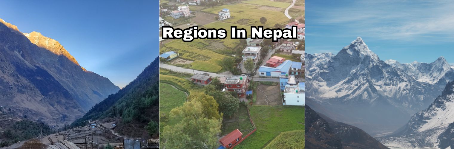
- Himalayan Region: 3,000–8,848 m, about 35% of land
- Hilly Region: 600–3,000 m, about 42–50%
- Terai Region: below 600 m, about 17–23%
The Himalayan Region includes peaks like Everest and high-altitude areas such as the Everest Region, Langtang Region, and Manaslu Region. The Hilly Region includes valleys such as Kathmandu at 1,350 m and much of Nepal’s mid-altitude areas. Meanwhile, the Terai Region, as low as 60 m, forms Nepal’s fertile southern plains.
These regions matter for climate, trekking seasons, agriculture, and biodiversity, which is why they remain widely used.
Difference Between Administrative and Geographic Regions
Administrative regions are about governance, while geographic regions are about landscape. Nepal’s 7 provinces exist to run government services, pass laws, and manage budgets. The 3 geographic regions exist to explain altitude, climate, and ecology.
A province can include all three geographic zones, while a geographic region can spread across multiple provinces. That overlap is why people often mix the terms.
Guidance: Provinces run the country; geographic regions explain it.
Why Nepal Changed From Development Regions to Provinces
Nepal shifted systems in 2015 to move away from centralized control. The 5 development regions lacked authority, budgets, and accountability. They coordinated plans but could not implement change.
The new federal system introduced three levels of government (federal, provincial, and local) to bring decision-making closer to people. The goal was better service delivery, fairer resource distribution, and recognition of regional identity.
Which Regional System Is Used Today?
For governance, Nepal uses only the 7 provinces. All laws, budgets, permits, and administration follow this structure. For education, geography, and travel descriptions, the 3 geographic regions are still widely used.
The 5 development regions are obsolete, but they appear in older documents and online sources created before 2015–2018.
Common Confusion About Nepal’s Regions
- “Region” and “province” are used interchangeably online
- Old content is still using pre-2015 systems
- Geographic regions mistaken for administrative units
- Travel blogs not updated after federal change
- Multiple systems are taught at different times
Nepal Regions Explained for Travelers and Learners
Travelers often hear about the Annapurna Region, Everest Region, Langtang Region, or Manaslu Region, which are geographic trekking regions, not provinces. These names help explain terrain, routes, and altitude—not government boundaries.
Maps may show provinces, while guides describe geographic regions. Both are correct, just used for different reasons.
Final Reality Check
Nepal doesn’t have one “regional” answer. It has three systems, each used for a reason. Officially, Nepal has 7 provinces. Geographically, it has 3 regions. Historically, it once had 5 development regions. Once you separate purpose from terminology, the confusion disappears.
In the end, understanding Nepal’s regions is not about memorizing numbers, it’s about knowing which map you’re looking at.
Optional Final Tables
Current systems at a glance
| System | Number | Status |
| Provinces | 7 | Active |
| Geographic regions | 3 | Active |
| Development regions | 5 | Discontinued |
FAQS
How many regions are there in Nepal officially?
Nepal officially has 7 provinces under the Constitution of 2015.
Are development regions still used in Nepal?
No. The 5 development regions were abolished in 2015.
Why do trekking regions differ from provinces?
Because trekking regions follow geography and altitude, not administration.
How many geographic regions are there in Nepal?
Nepal has 3 geographic regions. They are: Hilly, Himalayan, and Terai.